Looking for high-quality recording, editing and uploading of your trails to Google Street View? You’ve come to the right place. We will help you increase your trails digital presence.
About Us
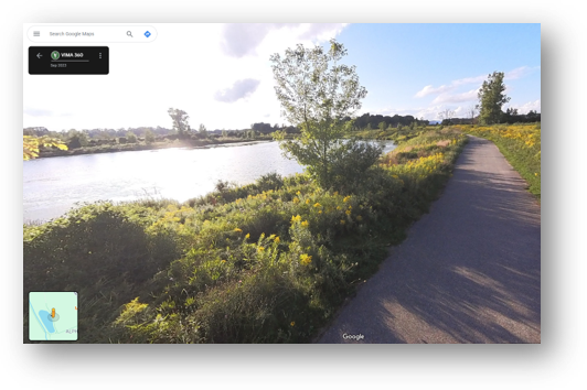
Vima360 is a full service Google Street View 360 virtual tour organization based out of Southwestern Ontario, focusing on helping communities upload local trails into Google Maps. We primarily work with municipalities, counties, tourism organizations, parks and conservation authorities, but will consult with other groups looking to use our service.
Improved Accessibility
High quality Street View tour can build credibility and trust with potential trail users, as it provides a visual confirmation of the level of accessibility of the trail.
Encouraging Trail Usage
Google Street View tours allow visitors to find local trails through Google Maps, providing a more dynamic and engaging way for them to explore your community. An additional feature of having your trails visible in Google Maps Street View is that it can better capture the attention of trail users and encourage them to visit your community.
First Impressions
Google Street View tours provide a more immersive and interactive experience for users, allowing them to virtually walkthrough your trails. This helps users properly prepare for the types of activates they can plan to engage in on the trail, which is especially valuable for first time visitors to your community.
Our Process
CONSULTATION
Meet and discuss types of trails in your community, project timeline, budget and answer any questions you may have about Vima360.
RECORDING
Our team goes onsite and records all of your trails in high-quality 360 degree panoramas.
EDITING
We use a third party app called GoThru to edit the 360 panoramas captured. This increases photo quality in preparation for uploading to Google Steet View.
UPLOADING
We upload the edited content to Google Street View, which usually takes about 1-2 weeks for their systems to review before the trail is live on Google Maps.
VIEWS
As people view the trail in Street View, Google monitors the number of views each trail accumulates. Every month we will send an updated view count to you. This will allow you to compare the viewership of different trails.
Pricing
Price will vary depending on the following factors:
number of kilometers
number of trails
size of municipality
*Recording 360 content with video versus photo will greatly reduce price/km, due to the reduction in editing, processing and uploading time. Note, this will be at the expense of content resolution. We are happy to discuss this with organizations interested in this option.